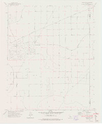
1973 Map of Boron NW
USGS Topo · Published 1976About this map
California City occupies a significant portion of this high desert landscape during its mid-1970s development phase. The street plan reveals a dense, intricate grid of suburban roads such as Washburn Boulevard and Rice Avenue, contrasting sharply with the expansive, undeveloped tracts of the Mojave Desert surrounding it. The northern section of the map is defined by the Twenty Mule Team Parkway, a name that evokes the region's historic mining and haulage legacy.
Find a feature on this map
18 named features on this map. Tap any name to fly to it.
Don’t see what you’re looking for? This feature index may not catch every label — zoom into the map to look around manually.
Map Details
Editions of this 1973 Boron NW Map
2 editions found
Other maps of this area

1903 · Randsburg
USGS Topo · 1:62,500

1911 · Randsburg
USGS Topo · 1:62,500

1912 · Randsburg
USGS Topo · 1:62,500

1915 · Searles Lake
USGS Topo · 1:250,000

1943 · Saltdale
USGS Topo · 1:62,500

1943 · Castle Butte
USGS Topo · 1:62,500

1947 · Castle Butte
USGS Topo · 1:50,000

1947 · Johannesburg SE
USGS Topo · 1:25,000
1947 · Castle Butte SE
USGS Topo · 1:24,000

1947 · Johannesburg SW
USGS Topo · 1:24,000