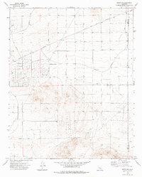
1973 Map of Boron NW
USGS Topo · Published 1976About this map
California City occupies the heart of this high-desert landscape, displaying a grid of planned but largely undeveloped thoroughfares that underscore the ambitious mid-century vision for this Mojave community. While primary routes like the Twenty Mule Team Parkway and Washburn Boulevard define the residential layouts, the terrain remains predominantly open. The arid nature of the region is evidenced by numerous dry features, including the Castle Butte Well (Dry) and another unnamed Well (Dry) to the east.
Find a feature on this map
25 named features on this map. Tap any name to fly to it.
Don’t see what you’re looking for? This feature index may not catch every label — zoom into the map to look around manually.
Map Details
Editions of this 1973 Boron NW Map
2 editions found
Other maps of this area

1903 · Randsburg
USGS Topo · 1:62,500

1911 · Randsburg
USGS Topo · 1:62,500

1912 · Randsburg
USGS Topo · 1:62,500

1915 · Searles Lake
USGS Topo · 1:250,000

1943 · Saltdale
USGS Topo · 1:62,500

1943 · Castle Butte
USGS Topo · 1:62,500

1947 · Castle Butte
USGS Topo · 1:50,000

1947 · Johannesburg SE
USGS Topo · 1:25,000
1947 · Castle Butte SE
USGS Topo · 1:24,000

1947 · Johannesburg SW
USGS Topo · 1:24,000