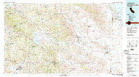
1982 Map of Borrego Valley
USGS Topo · Published 1983About this map
The Anza-Borrego Desert State Park dominates the eastern half of this 1982 landscape, where the transition from high forest to desert floor is sharply defined. Centered on the Valle De San Jose (Portilla) and the Lake Henshaw reservoir, the map documents a complex network of tribal lands including the Santa Ysabel Indian Reservation and Los Coyotes Indian Reservation. Settlement patterns are concentrated in pockets like Borrego Springs and Warner Springs, while the rugged southern terrain reveals the industrial traces of the Desert Queen Mine and the path of the San Diego and Arizona Eastern RR through the mountains. To the east, the Borrego Badlands and the edge of the Salton Sea illustrate the arid lower elevations of the Colorado Desert. This 1:100,000 scale view provides a high-level perspective of Southern California's interior before the intensification of modern development.
Find a feature on this map
63 named features on this map. Tap any name to fly to it.
Don’t see what you’re looking for? This feature index may not catch every label — zoom into the map to look around manually.
Map Details
Editions of this 1982 Borrego Valley Map
2 editions found
Other maps of this area

1893 · El Cajon
USGS Topo · 1:62,500

1893 · Escondido
USGS Topo · 1:62,500

1901 · Southern California Sheet No. 1
USGS Topo · 1:250,000

1901 · Elcajon
USGS Topo · 1:62,500

1901 · San Jacinto
USGS Topo · 1:125,000

1901 · Elsinore
USGS Topo · 1:125,000

1901 · Escondido
USGS Topo · 1:62,500

1901 · San Luis Rey
USGS Topo · 1:125,000

1903 · Cuyamaca
USGS Topo · 1:125,000

1903 · La Jolla
USGS Topo · 1:62,500