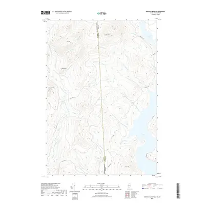
2018 Map of Bosebuck Mountain
USGS Topo · Published 2018About this map
The Maine-New Hampshire border cuts through this remote stretch of the Great North Woods, following the high ridges between Coos and Oxford counties. This landscape is defined by the headwaters of the East Branch Dead Diamond River, where the waters of Stub Hill Pond and Garfield Falls descend from the heights of Stub Hill. To the east, the terrain drops toward the expansive waters of Aziscohos Lake, a significant catchment fed by mountain streams such as N Fork Big Brook and Hammond Brook. Access to this timbered interior is largely restricted to a network of unpaved forest roads including Magalloway Rd and Parmachenee Rd, which trace the valleys between prominent peaks like Bosebuck Mtn and Haystack Mtn. The map highlights the complex drainage patterns and high-elevation topography characteristic of the upper Magalloway River watershed.
Find a feature on this map
29 named features on this map. Tap any name to fly to it.
Don’t see what you’re looking for? This feature index may not catch every label — zoom into the map to look around manually.
Map Details
Editions of this 2018 Bosebuck Mountain Map
This is the sole edition of this map. No revisions or reprints were ever made.
Other maps of this area

1927 · Second Lake
USGS Topo · 1:62,500

1930 · Errol
USGS Topo · 1:62,500

1931 · Cupsuptic
USGS Topo · 1:48,000

1932 · Second Lake
USGS Topo · 1:62,500

1934 · Cupsuptic
USGS Topo · 1:62,500

1934 · Errol
USGS Topo · 1:62,500

1935 · Cupsuptic
USGS Topo · 1:62,500

1940 · Oquossoc
USGS Topo · 1:62,500

1942 · Oquossoc
USGS Topo · 1:62,500

1949 · Jackman
USGS Topo · 1:250,000
Featured Places
- Pittsburg, NH
- Lynchtown Township, ME
- Atkinson and Gilmanton Academy Grant, NH
- Parkertown Township, ME
- Oxford County, ME