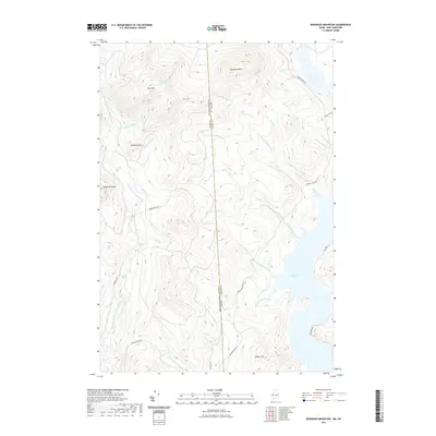
2021 Map of Bosebuck Mountain
USGS Topo · Published 2021About this map
The New Hampshire Maine border slices through this high-elevation wilderness, where the drainage systems of the East Branch Dead Diamond River and the Big Brook basin define the topography. Centered on the rugged peaks of the Coos and Oxford County line, the landscape is a network of steep ridges and deep brook valleys. To the northeast, Bosebuck Mountain overlooks the northern reaches of Aziscohos Lake, while Garfield Falls marks a significant drop in the western river system. Logging and access roads like Parmachenee Road and Magalloway Road wind through the forest, tracing paths used for generations in this timber-rich region. The presence of Stub Hill Pond near the summit of Stub Hill highlights the unique glacial hydrology of the area, providing a look at a remote mountain environment as it remained in the early 21st century.
Find a feature on this map
31 named features on this map. Tap any name to fly to it.
Don’t see what you’re looking for? This feature index may not catch every label — zoom into the map to look around manually.
Map Details
Editions of this 2021 Bosebuck Mountain Map
This is the sole edition of this map. No revisions or reprints were ever made.
Other maps of this area

1927 · Second Lake
USGS Topo · 1:62,500

1930 · Errol
USGS Topo · 1:62,500

1931 · Cupsuptic
USGS Topo · 1:48,000

1932 · Second Lake
USGS Topo · 1:62,500

1934 · Cupsuptic
USGS Topo · 1:62,500

1934 · Errol
USGS Topo · 1:62,500

1935 · Cupsuptic
USGS Topo · 1:62,500

1940 · Oquossoc
USGS Topo · 1:62,500

1942 · Oquossoc
USGS Topo · 1:62,500

1949 · Jackman
USGS Topo · 1:250,000
Featured Places
- Pittsburg, NH
- Lynchtown Township, ME
- Atkinson and Gilmanton Academy Grant, NH
- Parkertown Township, ME
- Oxford County, ME