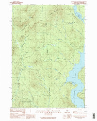
1989 Map of Bosebuck Mountain
USGS Topo · Published 1989About this map
Aziscohos Lake dominates the eastern landscape of this territory on the border of New Hampshire and Maine. The map details a transition from the highlands of Diamond Ridge and Bosebuck Mountain down to the water's edge, where a boat ramp and several inlets like Hammel Brook and Aldrich Brook mark the shoreline. Remote logging and mountain infrastructure are evident through features like Camp No 7, the Gravel Pit, and the route known as Boardpile.
Find a feature on this map
32 named features on this map. Tap any name to fly to it.
Don’t see what you’re looking for? This feature index may not catch every label — zoom into the map to look around manually.
Map Details
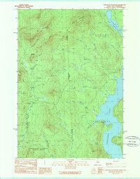
Editions of this 1989 Bosebuck Mountain Map
2 editions found
Other maps of this area

1927 · Second Lake
USGS Topo · 1:62,500

1930 · Errol
USGS Topo · 1:62,500

1931 · Cupsuptic
USGS Topo · 1:48,000

1932 · Second Lake
USGS Topo · 1:62,500

1934 · Cupsuptic
USGS Topo · 1:62,500

1934 · Errol
USGS Topo · 1:62,500

1935 · Cupsuptic
USGS Topo · 1:62,500

1940 · Oquossoc
USGS Topo · 1:62,500

1942 · Oquossoc
USGS Topo · 1:62,500

1949 · Jackman
USGS Topo · 1:250,000
Featured Places
- Pittsburg, NH
- Atkinson and Gilmanton Academy Grant, NH
- Lynchtown Township, ME
- Parkertown Township, ME
- Oxford County, ME