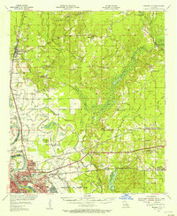
1955 Map of Bossier City
USGS Topo · Published 1956About this map
Bodcau Bayou and the complex wetlands of the Red River floodplain define this mid-century landscape of northern Louisiana. The map reveals a transition between the industrialized urban core of Bossier City and the surrounding rural parishes, where agriculture and resource extraction meet. Extensive levee systems and drainage works, such as the Drainage Canal and Willow Chute, illustrate the mid-century efforts to manage the river's influence on the land.
Find a feature on this map
84 named features on this map. Tap any name to fly to it.
Don’t see what you’re looking for? This feature index may not catch every label — zoom into the map to look around manually.
Map Details
Editions of this 1955 Bossier City Map
2 editions found
Other maps of this area

1922 · Sarepta
USGS Topo · 1:62,500

1924 · Sarepta
USGS Topo · 1:62,500

1932 · Bossier SE
USGS Topo · 1:31,680

1932 · Bossier NE
USGS Topo · 1:31,680

1932 · Bossier SW
USGS Topo · 1:31,680

1932 · Shreveport SE
USGS Topo · 1:31,680

1932 · Hosston SE
USGS Topo · 1:31,680

1932 · Bossier NW
USGS Topo · 1:31,680

1932 · Shreveport NE
USGS Topo · 1:31,680

1938 · Arnsberg
USGS Topo · 1:31,680