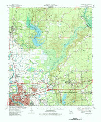
1978 Map of Bossier City
USGS Topo · Published 1986About this map
The Red River floodplain and the burgeoning urban landscape of Bossier City anchor this late-1970s survey of Bossier Parish. The map reveals a transition from the industrial and military core in the south—dominated by the expansive grounds of Barksdale Air Force Base and the rail corridors of the Illinois Central Gulf RR—to the hydraulic engineering projects further north. The newly created Cypress Bayou Reservoir, held by the Cypress Bayou Dam, illustrates the mid-century transformation of the local watershed. Notable for genealogists are numerous rural landmarks such as the Old Red River Cem and Macedonia Church, alongside civic additions like Louisiana Downs and Airline Community College. The northern reaches remain largely defined by the Bodcau State Wildlife Area and the meandering path of Bodcau Bayou, preserving a sense of the region's original wetlands.
Find a feature on this map
107 named features on this map. Tap any name to fly to it.
Don’t see what you’re looking for? This feature index may not catch every label — zoom into the map to look around manually.
Map Details
Editions of this 1978 Bossier City Map
2 editions found
Other maps of this area

1922 · Sarepta
USGS Topo · 1:62,500

1924 · Sarepta
USGS Topo · 1:62,500

1932 · Bossier SE
USGS Topo · 1:31,680

1932 · Bossier NE
USGS Topo · 1:31,680

1932 · Bossier SW
USGS Topo · 1:31,680

1932 · Shreveport SE
USGS Topo · 1:31,680

1932 · Hosston SE
USGS Topo · 1:31,680

1932 · Bossier NW
USGS Topo · 1:31,680

1932 · Shreveport NE
USGS Topo · 1:31,680

1938 · Arnsberg
USGS Topo · 1:31,680