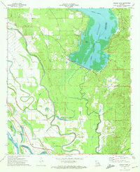
1972 Map of Bossier Point
USGS Topo · Published 1974About this map
Bossier Point defines the convergence of complex alluvial waterways in the early 1970s, where the Red River meanders through a landscape of shifting channels and bayous. The eastern portion of the sheet is dominated by the sprawling waters of Bistineau Lake, marked with an indefinite boundary and a spillway elevation of 141 feet. Along the western edge, the Kansas City Southern RR provides the primary rail corridor, passing through rural settlements like Cooterville and Poole. Local spiritual and community life is anchored by several small congregations, including Mt Nebo Ch and the Mary Magdalene Ch, the latter accompanied by the Mary Magdalene Cem. The intricate hydrology is evidenced by features like Hargis Bayou, Loggy Bayou, and Swan Lake, illustrating the heavy influence of the river system on local navigation and land use before further modern development.
Find a feature on this map
39 named features on this map. Tap any name to fly to it.
Don’t see what you’re looking for? This feature index may not catch every label — zoom into the map to look around manually.
Map Details
Editions of this 1972 Bossier Point Map
2 editions found
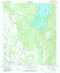
Other maps of this area

1938 · Arnsberg
USGS Topo · 1:31,680

1941 · East Point
USGS Topo · 1:31,680

1941 · Bossier Point
USGS Topo · 1:31,680

1945 · Mansfield
USGS Topo · 1:62,500

1947 · Ringgold
USGS Topo · 1:62,500

1947 · Mansfield
USGS Topo · 1:62,500

1948 · Coushatta
USGS Topo · 1:62,500

1948 · Caspiana
USGS Topo · 1:62,500

1955 · Shreveport
USGS Topo · 1:250,000

1955 · Caspiana
USGS Topo · 1:62,500