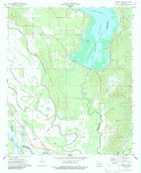
1972 Map of Bossier Point
USGS Topo · Published 1986About this map
Lake Bistineau dominates the northeastern landscape of this Bossier Parish region, its indefinite boundary and spillway elevation shaping the surrounding wetlands and drainage patterns. The intricate network of waterways, including Loggy Bayou, Flat River, and Ninock Bayou, defines the low-lying terrain as it approaches the Red River. Near the Kansas City Southern rail line, small settlements like Cooterville and Poole appear alongside local landmarks such as Mary Magdalene Church and its accompanying Cemetery. This 1970s survey captures a transition in the local economy, marked by the presence of an Oil Well near the river and a Gravel Pit to the east, while spiritual life is anchored by dispersed rural congregations at Mt Nebo Church and Fairview Church.
Find a feature on this map
41 named features on this map. Tap any name to fly to it.
Don’t see what you’re looking for? This feature index may not catch every label — zoom into the map to look around manually.
Map Details
Editions of this 1972 Bossier Point Map
2 editions found
Other maps of this area

1938 · Arnsberg
USGS Topo · 1:31,680

1941 · East Point
USGS Topo · 1:31,680

1941 · Bossier Point
USGS Topo · 1:31,680

1945 · Mansfield
USGS Topo · 1:62,500

1947 · Ringgold
USGS Topo · 1:62,500

1947 · Mansfield
USGS Topo · 1:62,500

1948 · Coushatta
USGS Topo · 1:62,500

1948 · Caspiana
USGS Topo · 1:62,500

1955 · Shreveport
USGS Topo · 1:250,000

1955 · Caspiana
USGS Topo · 1:62,500