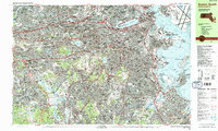
1987 Map of Boston South
USGS Topo · Published 1987About this map
The Charles River winds through this urban landscape, defining the borders between Cambridge, Waltham, and Newton during the late 1980s. This survey illustrates the dense concentration of academic and institutional life, from the campuses of Harvard University and the Massachusetts Institute of Technology to the extensive grounds of the Arnold Arboretum. Along the coast, the Boston Inner Harbor and Dorchester Bay reveal a waterfront in transition, featuring the U S Military Reservation and the prominent layout of Logan International Airport.
Find a feature on this map
174 named features on this map. Tap any name to fly to it.
Don’t see what you’re looking for? This feature index may not catch every label — zoom into the map to look around manually.
Map Details
Editions of this 1987 Boston South Map
2 editions found
Other maps of this area

1885 · Abington
USGS Topo · 1:62,500

1886 · Dedham
USGS Topo · 1:62,500

1886 · Framingham
USGS Topo · 1:62,500

1887 · Franklin
USGS Topo · 1:62,500

1888 · Abington
USGS Topo · 1:62,500

1889 · Franklin
USGS Topo · 1:62,500

1889 · Framingham
USGS Topo · 1:62,500

1892 · Boston Bay
USGS Topo · 1:62,500

1893 · Abington
USGS Topo · 1:62,500

1893 · Franklin
USGS Topo · 1:62,500