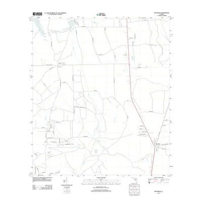
2012 Map of Bostwick
USGS Topo · Published 2012About this map
Bostwick and the small community of Sun Garden anchor this landscape in Putnam County, where the terrain is defined by a network of slow-moving waterways and drainage basins. The Sungarden Lookout Tower stands as a prominent landmark north of George S Lake Rd, signifying the area's history of timber management and fire surveillance. The map reveals a highly structured grid of rural roads, such as Old Bostwick Rd and Ozias Rd, which cut through a mosaic of wetlands and pine flatwoods. Hydrological features like Simms Cr, Hammock Br, and Harvey Cr wind through the region, illustrating the intricate drainage patterns essential to North Florida's ecology. This 2012 survey captures the transition from traditional rural homesteads to more modern residential road developments.
Find a feature on this map
62 named features on this map. Tap any name to fly to it.
Don’t see what you’re looking for? This feature index may not catch every label — zoom into the map to look around manually.
Map Details
Editions of this 2012 Bostwick Map
This is the sole edition of this map. No revisions or reprints were ever made.
Other maps of this area

1912 · Palatka
USGS Topo · 1:48,000

1915 · Palatka
USGS Topo · 1:62,500

1915 · Interlachen
USGS Topo · 1:48,000

1916 · Interlachen
USGS Topo · 1:62,500

1942 · Ates Creek
USGS Topo · 1:62,500

1944 · Interlachen
USGS Topo · 1:62,500

1947 · Bostwick
USGS Topo · 1:50,000

1949 · Rice Creek
USGS Topo · 1:24,000

1949 · Bostwick
USGS Topo · 1:24,000

1949 · Green Cove Springs
USGS Topo · 1:24,000