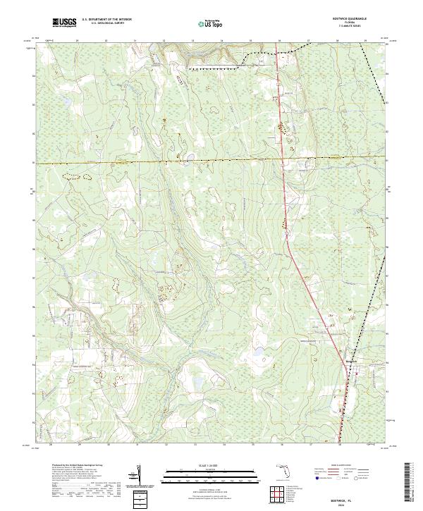
2024 Map of Bostwick
USGS Topo · Published 2024About this map
Bostwick anchors the southeastern corner of this landscape, positioned along a network of routes that reveal the rural character of northern Putnam County. The terrain is defined by a dense web of wetlands and small waterways, including the winding Simms Creek and Harvey Creek, which drain the low-lying interior. A series of residential and logging roads, such as Old Bostwick Rd and the curiously named Boogerville Rd, trace the high ground between the drainage basins of Hammock Branch and Clarkes Creek. To the north, the Clay Co. Putnam Co. boundary divides this forested expanse. For those researching local families, the Bostwick Cemetery provides a specific point of genealogical interest near the primary settlement, while names like Harvey Branch Rd and Varney Rd reflect the long-standing land-use patterns of this portion of the Florida interior.
Find a feature on this map
59 named features on this map. Tap any name to fly to it.
Don’t see what you’re looking for? This feature index may not catch every label — zoom into the map to look around manually.
Map Details
Editions of this 2024 Bostwick Map
This is the sole edition of this map. No revisions or reprints were ever made.
Other maps of this area

1912 · Palatka
USGS Topo · 1:48,000

1915 · Palatka
USGS Topo · 1:62,500

1915 · Interlachen
USGS Topo · 1:48,000

1916 · Interlachen
USGS Topo · 1:62,500

1942 · Ates Creek
USGS Topo · 1:62,500

1944 · Interlachen
USGS Topo · 1:62,500

1947 · Bostwick
USGS Topo · 1:50,000

1949 · Rice Creek
USGS Topo · 1:24,000

1949 · Bostwick
USGS Topo · 1:24,000

1949 · Green Cove Springs
USGS Topo · 1:24,000