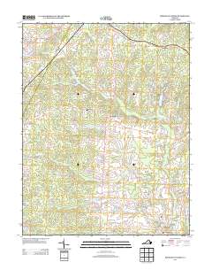
2013 Map of Boswells Tavern
USGS Topo · Published 2013About this map
The S Anna River and its numerous tributaries, including Hudson Cr and Lickinghole Cr, define the landscape of this central Virginia region. Small rural communities like Boswells Tavern and Waldrop are connected by a network of local roads that follow the undulating terrain of the Piedmont. The presence of Walkers Mill near the northern border and the Green Springs church to the south suggests a long history of local industry and social centers. Significant water bodies such as Lake Gordonsville, Hawkwood Lake, and Nininger Lake are scattered throughout, often appearing as impoundments on the creeks that feed into the larger river system. This area, which includes the settlements of Poindexter and Medlock, maintains a character shaped by its hydrography and agricultural heritage, with many landmarks like Nolting Pond and Purcell Lake serving as focal points for the surrounding rural parcels.
Find a feature on this map
94 named features on this map. Tap any name to fly to it.
Don’t see what you’re looking for? This feature index may not catch every label — zoom into the map to look around manually.
Map Details
Editions of this 2013 Boswells Tavern Map
This is the sole edition of this map. No revisions or reprints were ever made.
Other maps of this area

1891 · Palmyra
USGS Topo · 1:125,000

1892 · Gordonsville
USGS Topo · 1:125,000

1895 · Palmyra
USGS Topo · 1:125,000

1897 · Palmyra
USGS Topo · 1:125,000

1935 · Charlottesville
USGS Topo · 1:62,500

1939 · Charlottesville
USGS Topo · 1:62,500

1943 · Scottsville
USGS Topo · 1:62,500

1946 · Scottsville
USGS Topo · 1:62,500

1947 · Roanoke
USGS Topo · 1:250,000

1949 · Charlottesville
USGS Topo · 1:250,000