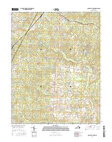
2016 Map of Boswells Tavern
USGS Topo · Published 2016About this map
Boswells Tavern stands as a focal point at the junction of the S Anna River and the rural road network of Louisa County and Albemarle County. This landscape is characterized by a series of small, scattered settlements including Waldrop, Lindsay, and Thelma, many of which developed around the local water systems and agricultural lands. The hydrology of the area is particularly complex, with features like Lake Gordonsville, Nininger Lake, and Hawkwood Lake dotting the terrain alongside numerous runs and creeks such as Bowlers Mill Run and Bunch Creek. Genealogists and local historians can find specific points of interest like the Watson Cemetery near Green Springs. The map reveals an area defined by long-standing property divisions and farm roads, including Meadows Farm and Bracketts Farm Road, reflecting a persistence of rural Virginia land use into the early twenty-first century.
Find a feature on this map
82 named features on this map. Tap any name to fly to it.
Don’t see what you’re looking for? This feature index may not catch every label — zoom into the map to look around manually.
Map Details
Editions of this 2016 Boswells Tavern Map
This is the sole edition of this map. No revisions or reprints were ever made.
Other maps of this area

1891 · Palmyra
USGS Topo · 1:125,000

1892 · Gordonsville
USGS Topo · 1:125,000

1895 · Palmyra
USGS Topo · 1:125,000

1897 · Palmyra
USGS Topo · 1:125,000

1935 · Charlottesville
USGS Topo · 1:62,500

1939 · Charlottesville
USGS Topo · 1:62,500

1943 · Scottsville
USGS Topo · 1:62,500

1946 · Scottsville
USGS Topo · 1:62,500

1947 · Roanoke
USGS Topo · 1:250,000

1949 · Charlottesville
USGS Topo · 1:250,000