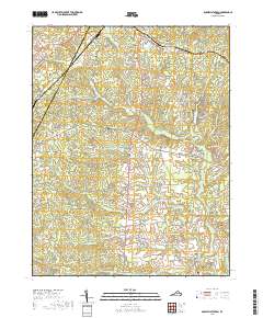
2019 Map of Boswells Tavern
USGS Topo · Published 2019About this map
Boswells Tavern stands at the heart of this rural Piedmont landscape, where the historical road network of Louisa Co and Albemarle Co converges. The terrain is defined by the winding course of the S Anna River, which feeds into the South Anna River near the settlement of Poindexter. This 2019 survey documents a region where agricultural traditions persist alongside modern infrastructure. Notable landmarks include Watson Cem and several private water bodies such as Hawkwood Lake and Nininger Lake. The map reveals the intricate drainage patterns of the area, with numerous small streams like Lickinghole Cr and Bunch Cr carving through the low hills. Scattered settlements such as Lindsay, Waldrop, and Thelma are connected by a web of rural routes including Louisa Rd and Gordonsville Rd, tracing paths that have likely served local residents for generations.
Find a feature on this map
88 named features on this map. Tap any name to fly to it.
Don’t see what you’re looking for? This feature index may not catch every label — zoom into the map to look around manually.
Map Details
Editions of this 2019 Boswells Tavern Map
This is the sole edition of this map. No revisions or reprints were ever made.
Other maps of this area

1891 · Palmyra
USGS Topo · 1:125,000

1892 · Gordonsville
USGS Topo · 1:125,000

1895 · Palmyra
USGS Topo · 1:125,000

1897 · Palmyra
USGS Topo · 1:125,000

1935 · Charlottesville
USGS Topo · 1:62,500

1939 · Charlottesville
USGS Topo · 1:62,500

1943 · Scottsville
USGS Topo · 1:62,500

1946 · Scottsville
USGS Topo · 1:62,500

1947 · Roanoke
USGS Topo · 1:250,000

1949 · Charlottesville
USGS Topo · 1:250,000