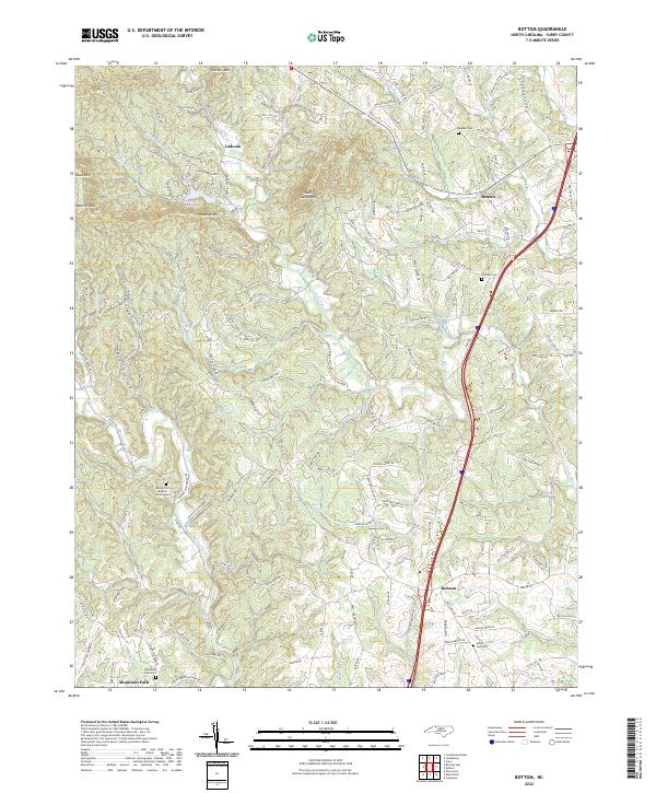
2022 Map of Bottom
USGS Topo · Published 2022About this map
The Fisher River and Mitchell River carve through the foothills of the Blue Ridge in this section of Surry County, where the terrain rises toward significant heights like Skull Camp Mtn and Raven Knob. The 2022 landscape shows a pattern of rural communities such as Ladonia and Beulah connected by a dense network of local roads including Blevins Store Rd and Old House Trl. These labels often hint at earlier landmarks and homesteads that have shaped the local identity. Local history is anchored by spiritual and commemorative sites, including Rocky Ford Baptist Church and the Salem Fork Cem near the town of Dobson. The map documents the modern footprint of these long-established communities, showing how contemporary infrastructure like Interstate 77 bisects older drainage basins and mountain spurs, providing a clear view of how development interacts with the natural topography.
Find a feature on this map
156 named features on this map. Tap any name to fly to it.
Don’t see what you’re looking for? This feature index may not catch every label — zoom into the map to look around manually.
Map Details
Editions of this 2022 Bottom Map
This is the sole edition of this map. No revisions or reprints were ever made.
Other maps of this area

1889 · Hillsville
USGS Topo · 1:125,000

1891 · Yadkinville
USGS Topo · 1:125,000

1892 · Hillsville
USGS Topo · 1:125,000

1893 · Yadkinville
USGS Topo · 1:125,000

1896 · Hillsville
USGS Topo · 1:125,000

1931 · Galax
USGS Topo · 1:48,000

1933 · Galax
USGS Topo · 1:62,500

1953 · Winston-Salem
USGS Topo · 1:250,000

1955 · Winston-Salem
USGS Topo · 1:250,000

1957 · Mount Airy
USGS Topo · 1:62,500