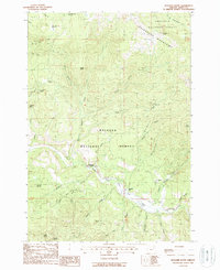
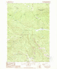
1988 Map of Boulder Butte
USGS Topo · Published 1988About this map
The Greenhorn Mountains form the backdrop of this late 1980s resource-rich landscape where mining and timber management converge. Spanning the boundary between Umatilla National Forest and Malheur National Forest, the region is defined by deep drainages like Big Boulder Creek and the John Day River. For the industrial historian, the map documents a legacy of extraction, from the China Diggings Mine and Stalter Mine to several tunnels and a quarry. Water management is central to the area's history, marked by numerous developed springs such as Piute Spring and Crockett Spring. The Sunshine Guard Station serves as a lone administrative hub amidst the ridges, overseeing a network of trails and primitive roads like Riverside Gulch that supported the area's rugged economic activity.
Find a feature on this map
52 named features on this map. Tap any name to fly to it.
Don’t see what you’re looking for? This feature index may not catch every label — zoom into the map to look around manually.
Map Details
Editions of this 1988 Boulder Butte Map
2 editions found
Other maps of this area

1949 · Susanville
USGS Topo · 1:62,500

1951 · Susanville
USGS Topo · 1:62,500

1951 · Dale
USGS Topo · 1:62,500

1951 · Bates
USGS Topo · 1:62,500

1951 · Desolation Butte
USGS Topo · 1:62,500

1955 · Canyon City
USGS Topo · 1:250,000

1959 · Canyon City
USGS Topo · 1:250,000
1987 · Bates
USGS Topo · 1:100,000
1988 · Vinegar Hill
USGS Topo · 1:24,000
1988 · Desolation Butte
USGS Topo · 1:24,000