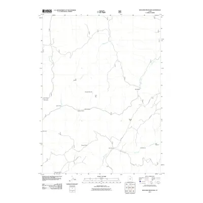
2011 Map of Boulder Mountain
USGS Topo · Published 2011About this map
Boulder Mountain dominates this portion of the Bear River Range in northern Utah, where deep drainages and high plateaus define the landscape. The Lucky Star Mine sits high on the slopes above Munson Hollow and Cabin Hollow, a reminder of the prospecting history in these mountains. Below the summits, the terrain levels out into broad areas such as Pleasant Valley and Squaw Flat, which likely provided forage for early livestock operations. A network of forest roads, including Laketown Rd and Peavine Rd, snakes through the hollows to connect isolated locations like Little Peavine and Big Peavine. The hydrology of the area is primarily shaped by Sheep Creek, Rock Creek, and Saddle Creek, which drain the eastern and western slopes of the central ridge. These geographic features illustrate the transition from high-elevation peaks to the lower valleys that border the Uinta-Wasatch-Cache National Forest.
Find a feature on this map
23 named features on this map. Tap any name to fly to it.
Don’t see what you’re looking for? This feature index may not catch every label — zoom into the map to look around manually.
Map Details
Editions of this 2011 Boulder Mountain Map
This is the sole edition of this map. No revisions or reprints were ever made.
Other maps of this area

1912 · Randolph
USGS Topo · 1:125,000

1914 · Logan
USGS Topo · 1:125,000

1916 · Logan
USGS Topo · 1:125,000

1949 · Boulter Mts
USGS Topo · 1:24,000

1954 · Ogden
USGS Topo · 1:250,000

1958 · Ogden
USGS Topo · 1:250,000

1960 · Ogden
USGS Topo · 1:250,000

1969 · Boulder Mtn
USGS Topo · 1:24,000
1969 · Porcupine Reservoir
USGS Topo · 1:24,000
1969 · Hardware Ranch
USGS Topo · 1:24,000