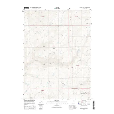
2014 Map of Boulder Mountain
USGS Topo · Published 2014About this map
Monte Cristo Range topography dominates this high-altitude landscape within the Cache National Forest. The area is characterized by a dense network of mountain springs and named hollows that served as vital landmarks for early ranchers and travelers. Significant water sources like Dog Spring, Marie Spring, and Heber Spring dot the terrain, sustaining life in the high basins of Elk Valley and Pleasant Valley.
Find a feature on this map
52 named features on this map. Tap any name to fly to it.
Don’t see what you’re looking for? This feature index may not catch every label — zoom into the map to look around manually.
Map Details
Editions of this 2014 Boulder Mountain Map
This is the sole edition of this map. No revisions or reprints were ever made.
Other maps of this area

1912 · Randolph
USGS Topo · 1:125,000

1914 · Logan
USGS Topo · 1:125,000

1916 · Logan
USGS Topo · 1:125,000

1949 · Boulter Mts
USGS Topo · 1:24,000

1954 · Ogden
USGS Topo · 1:250,000

1958 · Ogden
USGS Topo · 1:250,000

1960 · Ogden
USGS Topo · 1:250,000

1969 · Boulder Mtn
USGS Topo · 1:24,000
1969 · Porcupine Reservoir
USGS Topo · 1:24,000
1969 · Hardware Ranch
USGS Topo · 1:24,000