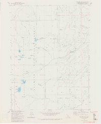
1981 Map of Boulder Peak
USGS Topo · Published 1981About this map
Marble Mountain Wilderness defines the character of this high-elevation landscape within the Klamath National Forest. The 1981 survey reveals a complex network of alpine water bodies, including the high-altitude Cliff Lake and Campbell Lake situated near the base of prominent peaks. A stretch of the Pacific Crest National Scenic Trail winds through the southwestern corner, reflecting the region's importance for long-distance recreation during the late twentieth century. Landforms like Boulder Peak and Red Mountain anchor the terrain, while numerous meadows such as Big Meadows and Sniktaw Meadow suggest pockets of grazing or seasonal ecology amidst the steep canyons. Waterways like Shackleford Creek and Mill Creek drain the slopes, punctuated by clusters of small lakes like Lower Wright Lake and Upper Wright Lake. This map serves as a primary record of the remote backcountry before more modern forest management practices or environmental changes shifted the wilderness character.
Find a feature on this map
54 named features on this map. Tap any name to fly to it.
Don’t see what you’re looking for? This feature index may not catch every label — zoom into the map to look around manually.
Map Details
Editions of this 1981 Boulder Peak Map
2 editions found
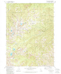
Other maps of this area

1886 · Shasta
USGS Topo · 1:250,000

1894 · Shasta
USGS Topo · 1:250,000

1914 · Seiad
USGS Topo · 1:125,000

1922 · Seiad
USGS Topo · 1:125,000

1923 · Sawyers Bar
USGS Topo · 1:125,000

1931 · Etna
USGS Topo · 1:96,000

1932 · Yreka
USGS Topo · 1:96,000

1934 · Etna
USGS Topo · 1:125,000

1939 · Yreka
USGS Topo · 1:125,000

1948 · Weed
USGS Topo · 1:250,000