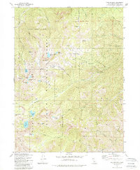
1981 Map of Boulder Peak
USGS Topo · Published 1981About this map
Boulder Peak stands as a central landmark within this portion of the Marble Mountain Wilderness, a high-elevation terrain characterized by numerous glacial tarns and alpine meadows. The 1981 survey reveals a complex network of backcountry routes, including the Pacific Crest Scenic Trail and various unnamed pack trails that navigate the steep ridges between Klamath National Forest and the surrounding peaks.
Find a feature on this map
53 named features on this map. Tap any name to fly to it.
Don’t see what you’re looking for? This feature index may not catch every label — zoom into the map to look around manually.
Map Details
Editions of this 1981 Boulder Peak Map
2 editions found
Other maps of this area

1886 · Shasta
USGS Topo · 1:250,000

1894 · Shasta
USGS Topo · 1:250,000

1914 · Seiad
USGS Topo · 1:125,000

1922 · Seiad
USGS Topo · 1:125,000

1923 · Sawyers Bar
USGS Topo · 1:125,000

1931 · Etna
USGS Topo · 1:96,000

1932 · Yreka
USGS Topo · 1:96,000

1934 · Etna
USGS Topo · 1:125,000

1939 · Yreka
USGS Topo · 1:125,000

1948 · Weed
USGS Topo · 1:250,000