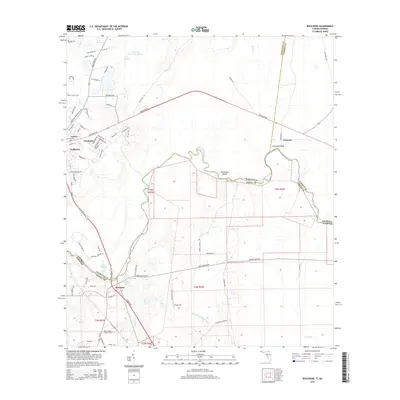
2015 Map of Boulogne
USGS Topo · Published 2015About this map
The Saint Marys River carves a winding path along the Georgia and Florida border, defining the landscape of this 2015 survey. This interstate boundary separates Charlton and Camden counties in Georgia from Nassau County in Florida, with the small settlement of Boulogne serving as a primary crossing point. To the north, the town of Folkston serves as a local hub, surrounded by established residential neighborhoods like Pinehurst and Layton.
Find a feature on this map
85 named features on this map. Tap any name to fly to it.
Don’t see what you’re looking for? This feature index may not catch every label — zoom into the map to look around manually.
Map Details
Editions of this 2015 Boulogne Map
This is the sole edition of this map. No revisions or reprints were ever made.
Other maps of this area

1917 · Boulogne
USGS Topo · 1:62,500

1917 · Hilliard
USGS Topo · 1:62,500

1918 · Folkston
USGS Topo · 1:62,500

1918 · Moniac
USGS Topo · 1:62,500

1919 · Hilliard
USGS Topo · 1:62,500

1919 · Boulogne
USGS Topo · 1:62,500

1942 · Moniac
USGS Topo · 1:62,500

1948 · Jacksonville
USGS Topo · 1:250,000

1954 · Valdosta
USGS Topo · 1:250,000

1957 · Jacksonville
USGS Topo · 1:250,000