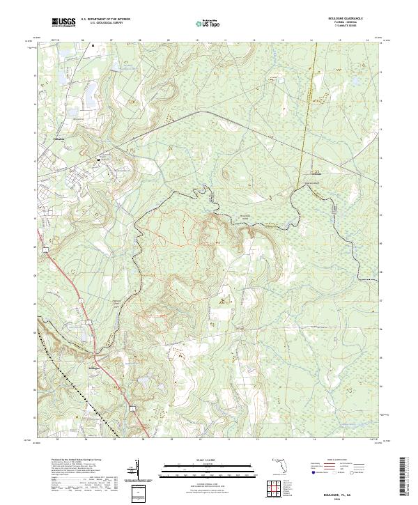
2024 Map of Boulogne
USGS Topo · Published 2024About this map
The Saint Marys River carves a winding path across the landscape, serving as the natural boundary between Georgia and Florida. This riverine environment is defined by its dramatic bluffs and low-lying wetlands, most notably at Coleraine Bluff and May Bluff. The area near Folkston and Colerain shows a blend of established settlements and protected natural land, with the Ralph E Simmons Memorial State Forest preserving a significant portion of the river's southern banks.
Find a feature on this map
79 named features on this map. Tap any name to fly to it.
Don’t see what you’re looking for? This feature index may not catch every label — zoom into the map to look around manually.
Map Details
Editions of this 2024 Boulogne Map
This is the sole edition of this map. No revisions or reprints were ever made.
Other maps of this area

1917 · Boulogne
USGS Topo · 1:62,500

1917 · Hilliard
USGS Topo · 1:62,500

1918 · Folkston
USGS Topo · 1:62,500

1918 · Moniac
USGS Topo · 1:62,500

1919 · Hilliard
USGS Topo · 1:62,500

1919 · Boulogne
USGS Topo · 1:62,500

1942 · Moniac
USGS Topo · 1:62,500

1948 · Jacksonville
USGS Topo · 1:250,000

1954 · Valdosta
USGS Topo · 1:250,000

1957 · Jacksonville
USGS Topo · 1:250,000