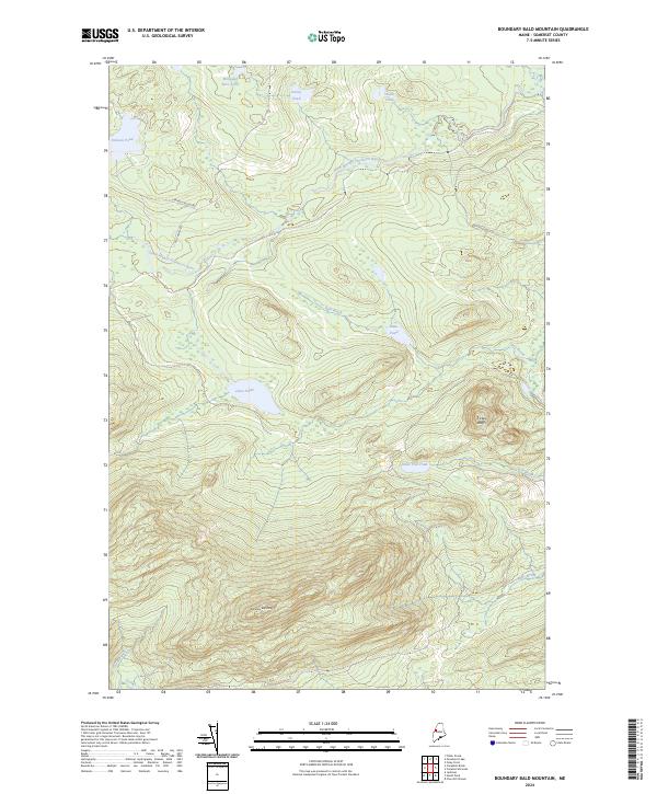
2024 Map of Boundary Bald Mountain
USGS Topo · Published 2024About this map
Boundary Bald Mtn dominates the southern half of this Somerset County landscape, serving as a primary drainage divide for numerous high-altitude water bodies. The northern slopes feed into the South Branch Penobscot River, a significant waterway that winds through the timberlands. This area is defined by its dense network of ponds and brooks, including the evocatively named Wounded Deer Pond and Hutch Pond in the north, and Jones Pond centrally located below the peaks. Human activity is represented by the S Branch Access Rd and Old Cheney Rd, which provide passage through the dense forest. Further east, the terrain breaks at Trickey Bluffs, overlooking the headwaters of Fish Brook. This map provides a detailed view of the North Maine Woods' hydrography and elevation just before the Canadian border.
Find a feature on this map
16 named features on this map. Tap any name to fly to it.
Don’t see what you’re looking for? This feature index may not catch every label — zoom into the map to look around manually.
Map Details
Editions of this 2024 Boundary Bald Mountain Map
This is the sole edition of this map. No revisions or reprints were ever made.
Other maps of this area

1922 · Long Pond
USGS Topo · 1:62,500

1923 · Attean
USGS Topo · 1:62,500

1924 · Long Pond
USGS Topo · 1:62,500

1925 · Attean
USGS Topo · 1:62,500

1927 · Sandy Bay
USGS Topo · 1:48,000

1930 · Sandy Bay
USGS Topo · 1:62,500

1944 · Long Pond
USGS Topo · 1:62,500

1944 · Sandy Bay
USGS Topo · 1:62,500

1949 · Jackman
USGS Topo · 1:250,000

1950 · Attean
USGS Topo · 1:50,000
Featured Places
- Moose River, ME
- Thorndike Township, ME
- Alder Brook Township, ME
- Hammond Township, ME
- Prentiss Township, ME