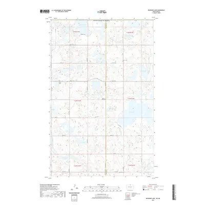
2020 Map of Boundary Lake
USGS Topo · Published 2020About this map
The Turtle Mountains define this international border landscape, where the prairie of Rolette and Bottineau Counties meets the Canadian frontier. This high-altitude plateau is densely pockmarked by glacial potholes and terminal moraine lakes, including the sprawling Willow Lake and the border-straddling Boundary Lake. The region's early 20th-century settlement is evidenced by a network of rural roads such as 106th St NE and localized community anchors that remain today.
Find a feature on this map
35 named features on this map. Tap any name to fly to it.
Don’t see what you’re looking for? This feature index may not catch every label — zoom into the map to look around manually.
Map Details
Editions of this 2020 Boundary Lake Map
This is the sole edition of this map. No revisions or reprints were ever made.
Other maps of this area

1935 · Dunseith
USGS Topo · 1:48,000

1939 · Dunseith
USGS Topo · 1:62,500

1954 · Minot
USGS Topo · 1:250,000

1955 · Lords Lake
USGS Topo · 1:24,000

1955 · Dunseith
USGS Topo · 1:24,000

1955 · Bottineau SE
USGS Topo · 1:24,000

1956 · Metigoshe Lake
USGS Topo · 1:24,000
1956 · Lords Lake
USGS Topo · 1:25,000

1958 · Minot
USGS Topo · 1:250,000
1968 · International Peace Garden
USGS Topo · 1:24,000