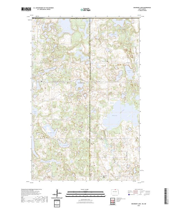
2024 Map of Boundary Lake
USGS Topo · Published 2024About this map
Turtle Mountains terrain defines this international border landscape where the Bottineau Co Rolette Co line intersects the United States of America boundary. The area is characterized by a dense network of glacial lakes and protected wetlands, including the Rabb Lake National Wildlife Refuge and the Willow Lake National Wildlife Refuge. These managed lands, alongside various Waterfowl Production Areas, emphasize the region's importance for conservation and migratory birds.
Find a feature on this map
49 named features on this map. Tap any name to fly to it.
Don’t see what you’re looking for? This feature index may not catch every label — zoom into the map to look around manually.
Map Details
Editions of this 2024 Boundary Lake Map
This is the sole edition of this map. No revisions or reprints were ever made.
Other maps of this area

1935 · Dunseith
USGS Topo · 1:48,000

1939 · Dunseith
USGS Topo · 1:62,500

1954 · Minot
USGS Topo · 1:250,000

1955 · Lords Lake
USGS Topo · 1:24,000

1955 · Dunseith
USGS Topo · 1:24,000

1955 · Bottineau SE
USGS Topo · 1:24,000

1956 · Metigoshe Lake
USGS Topo · 1:24,000
1956 · Lords Lake
USGS Topo · 1:25,000

1958 · Minot
USGS Topo · 1:250,000
1968 · International Peace Garden
USGS Topo · 1:24,000