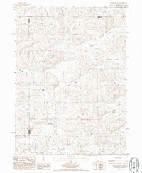
1986 Map of Bourquim Hill
USGS Topo · Published 1986About this map
Bourquim Hill rises as a prominent landmark in this section of the Nebraska Sandhills, where the landscape is defined by a rhythmic series of northwest-to-southeast trending valleys. These depressions, such as Dunlap Valley, Cochran Valley, and Benscoter Valley, provided the essential flat ground for early ranching operations in this arid region. The map reveals the sparse but intentional human presence on the land, anchored by the F Lane Ranch and the isolated Cocklebur Windmill, which served as a critical water source for livestock. This 1980s survey captures the intersection of Arthur, Garden, and Grant counties, preserving the names of family-held lands and geographic features like Stinsman Valley and Doherty Valley that remain central to the area's local history and cattle-rearing identity.
Find a feature on this map
19 named features on this map. Tap any name to fly to it.
Don’t see what you’re looking for? This feature index may not catch every label — zoom into the map to look around manually.
Map Details
Editions of this 1986 Bourquim Hill Map
This is the sole edition of this map. No revisions or reprints were ever made.
Other maps of this area

1948 · George Lake
USGS Topo · 1:62,500

1949 · Rackett
USGS Topo · 1:62,500

1950 · Velma
USGS Topo · 1:62,500

1950 · George Lake
USGS Topo · 1:62,500

1950 · Longfellow Lake
USGS Topo · 1:62,500

1951 · Rackett
USGS Topo · 1:62,500

1954 · Scottsbluff
USGS Topo · 1:250,000

1954 · North Platte
USGS Topo · 1:250,000

1956 · North Platte
USGS Topo · 1:250,000

1957 · North Platte
USGS Topo · 1:250,000