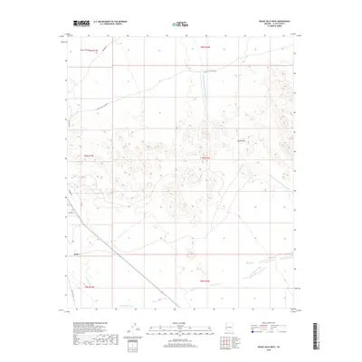
2018 Map of Bouse Hills West
USGS Topo · Published 2018About this map
Bouse occupies the southwestern corner of this desert landscape, serving as a primary settlement point amidst the arid reaches of the Cactus Plain. The map documents a rugged terrain defined by the Bouse Hills, where the land rises sharply from the surrounding alluvial flats. A major infrastructure feature, the Central Arizona Project Aqueduct, cuts across the northeastern and eastern portions of the quadrangle, illustrating the modern engineering required to move water through this section of Arizona. Seasonal water patterns are marked by the presence of Bouse Wash and Cunningham Wash, which provide the primary drainage routes during infrequent desert rains. Local transit is facilitated by historically resonant routes such as Stage Coach Rd and Swansea Rd, which connect this remote area to broader regional networks. The arrangement of section lines and range boundaries like t7n r16w provides a clear framework for those studying land ownership and desert settlement patterns in this part of La Paz County.
Find a feature on this map
17 named features on this map. Tap any name to fly to it.
Don’t see what you’re looking for? This feature index may not catch every label — zoom into the map to look around manually.
Map Details
Editions of this 2018 Bouse Hills West Map
This is the sole edition of this map. No revisions or reprints were ever made.
Other maps of this area

1911 · Parker
USGS Topo · 1:125,000

1923 · Signal
USGS Topo · 1:250,000

1930 · Linskey
USGS Topo · 1:62,500

1942 · Signal
USGS Topo · 1:250,000

1942 · Blythe
USGS Topo · 1:250,000

1942 · Vicksburg
USGS Topo · 1:250,000

1950 · Prescott
USGS Topo · 1:250,000

1954 · Salton Sea
USGS Topo · 1:250,000

1954 · Needles
USGS Topo · 1:250,000

1954 · Prescott
USGS Topo · 1:250,000