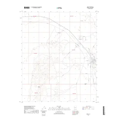
2018 Map of Bouse
USGS Topo · Published 2018About this map
Bouse sits at the intersection of desert plains and mountain foothills, serving as a hub for the surrounding arid landscape of La Paz County. The settlement is defined by a traditional grid of streets such as Broadway Ave and Santa Fe Ave, situated just south of where Bouse Wash cuts across the Cactus Plain. To the west, the jagged edges of the Plomosa Mountains rise abruptly, while the Ranegras Plain stretches to the southeast. This 2018 survey illustrates the modern road network connecting the town to the hinterlands, including La Posa Rd and the path toward Little Butte. The map documents the enduring spatial layout of this desert community, where local thoroughfares like Rainbow Ave and Stage Coach RD hint at the region's western heritage and transit history.
Find a feature on this map
41 named features on this map. Tap any name to fly to it.
Don’t see what you’re looking for? This feature index may not catch every label — zoom into the map to look around manually.
Map Details
Editions of this 2018 Bouse Map
This is the sole edition of this map. No revisions or reprints were ever made.
Other maps of this area

1911 · Parker
USGS Topo · 1:125,000

1923 · Signal
USGS Topo · 1:250,000

1930 · Linskey
USGS Topo · 1:62,500

1942 · Signal
USGS Topo · 1:250,000

1942 · Blythe
USGS Topo · 1:250,000

1942 · Vicksburg
USGS Topo · 1:250,000

1950 · Prescott
USGS Topo · 1:250,000

1954 · Salton Sea
USGS Topo · 1:250,000

1954 · Needles
USGS Topo · 1:250,000

1954 · Prescott
USGS Topo · 1:250,000