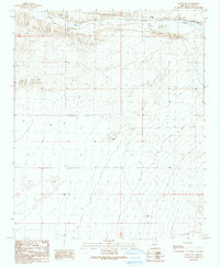
1990 Map of Bouse NW
USGS Topo · Published 1990About this map
Bouse Wash dominates the northern desert landscape of this quadrangle in La Paz County, carving a wide alluvial path through the arid terrain. Compiled from aerial photography dating back to the 1950s and updated through the late 1980s, the map illustrates a sparsely populated region defined by utility infrastructure and natural drainage patterns. Industrial markers such as Substations and a isolated Water Tank are the primary human imprints on the land, situated alongside topographic identifiers like the prominent Wall formation. The grid of township and range lines, including T 8 N and R 19 W, provides the essential framework for locating these desert features within the Western Arizona expanse.
Find a feature on this map
7 named features on this map. Tap any name to fly to it.
Don’t see what you’re looking for? This feature index may not catch every label — zoom into the map to look around manually.
Map Details
Editions of this 1990 Bouse NW Map
This is the sole edition of this map. No revisions or reprints were ever made.
Other maps of this area

1911 · Parker
USGS Topo · 1:125,000

1930 · Linskey
USGS Topo · 1:62,500

1931 · Moon Mtn
USGS Topo · 1:62,500

1932 · Moon Mtn
USGS Topo · 1:62,500

1942 · Blythe
USGS Topo · 1:250,000

1942 · MOON MTN
USGS Topo · 1:62,500

1943 · Parker
USGS Topo · 1:62,500

1949 · Parker
USGS Topo · 1:62,500

1950 · Parker
USGS Topo · 1:62,500

1954 · Salton Sea
USGS Topo · 1:250,000