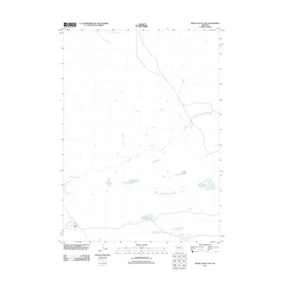
2011 Map of Bovee Valley East
USGS Topo · Published 2011About this map
The Snake River winds through this Nebraska landscape, carving a path through the terrain of Bovee Valley. This 2011 survey, produced by the U.S. Geological Survey, details a region characterized by its numerous natural water bodies. The hydrology of the area is well-defined by clusters of lakes, including Hackberry Lake, Chokecherry Lake, and the larger Big Lake. These features, along with Hart Lake and Cedar Lake, indicate a significant basin system that dominates the local geography. The map illustrates the sparse infrastructure typical of this part of Cherry County, focusing instead on the natural drainage patterns and the relationship between the river valley and the surrounding high plains.
Find a feature on this map
7 named features on this map. Tap any name to fly to it.
Don’t see what you’re looking for? This feature index may not catch every label — zoom into the map to look around manually.
Map Details
Editions of this 2011 Bovee Valley East Map
This is the sole edition of this map. No revisions or reprints were ever made.
Other maps of this area

1948 · Spade Ranch
USGS Topo · 1:62,500

1949 · Turpin Lake
USGS Topo · 1:62,500

1950 · Spade Ranch
USGS Topo · 1:62,500

1951 · Gypsy Valley
USGS Topo · 1:62,500

1951 · Turpin Lake
USGS Topo · 1:62,500

1955 · Alliance
USGS Topo · 1:250,000

1957 · Alliance
USGS Topo · 1:250,000

1957 · Valentine
USGS Topo · 1:250,000

1958 · Alliance
USGS Topo · 1:250,000

1959 · Valentine
USGS Topo · 1:250,000