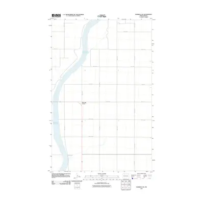
2011 Map of Bowbells SE
USGS Topo · Published 2011About this map
Upper Des Lacs Lake dominates the western portion of this Burke County landscape, carving a deep valley through the northern prairie. This 2011 survey reveals the highly organized grid of rural section lines and township roads that define the agricultural character of the region. A notable point of orientation is Nine Mile Corner, where several local routes converge. The map documents the layout of gravel and paved roads such as 63rd Ave NW and 548th Ave NW, which facilitate transport across the open plains toward the lake basin. The lack of dense development underscores the area's rural nature, focused on the intersection of the natural waterway and the human-made grid system common to this part of North Dakota.
Find a feature on this map
22 named features on this map. Tap any name to fly to it.
Don’t see what you’re looking for? This feature index may not catch every label — zoom into the map to look around manually.
Map Details
Editions of this 2011 Bowbells SE Map
This is the sole edition of this map. No revisions or reprints were ever made.
Other maps of this area

1947 · Bowbells NW
USGS Topo · 1:24,000

1947 · Tolley
USGS Topo · 1:62,500

1947 · Bowbells
USGS Topo · 1:24,000

1948 · Kenmare
USGS Topo · 1:24,000

1948 · Norma
USGS Topo · 1:24,000

1948 · Mouse River Park NW
USGS Topo · 1:24,000

1949 · Bowbells
USGS Topo · 1:24,000

1949 · Mouse River Park NW
USGS Topo · 1:24,000

1949 · Bowbells SE
USGS Topo · 1:24,000

1949 · Bowbells NW
USGS Topo · 1:24,000