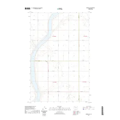
2020 Map of Bowbells SE
USGS Topo · Published 2020About this map
Upper Des Lacs Lake defines the western edge of this prairie landscape, where the borders of Burke, Ward, and Renville counties converge. This 2020 survey by the U.S. Geological Survey illustrates the rigid section-line road network that organizes the agricultural interior of the Northern Plains. The intersection of 96th St NW and 506th St NW serves as a primary local corridor, while the terrain's subtle relief is marked by numerous small wetlands and drainage patterns characteristic of the drift prairie. Genealogists and local historians can trace property boundaries and access routes across townships T162N R88W and T161N R88W, identifying the precise location of farmstead approaches such as 100th St NW and 506th Ave NW.
Find a feature on this map
25 named features on this map. Tap any name to fly to it.
Don’t see what you’re looking for? This feature index may not catch every label — zoom into the map to look around manually.
Map Details
Editions of this 2020 Bowbells SE Map
This is the sole edition of this map. No revisions or reprints were ever made.
Other maps of this area

1947 · Bowbells NW
USGS Topo · 1:24,000

1947 · Tolley
USGS Topo · 1:62,500

1947 · Bowbells
USGS Topo · 1:24,000

1948 · Kenmare
USGS Topo · 1:24,000

1948 · Norma
USGS Topo · 1:24,000

1948 · Mouse River Park NW
USGS Topo · 1:24,000

1949 · Bowbells
USGS Topo · 1:24,000

1949 · Mouse River Park NW
USGS Topo · 1:24,000

1949 · Bowbells SE
USGS Topo · 1:24,000

1949 · Bowbells NW
USGS Topo · 1:24,000