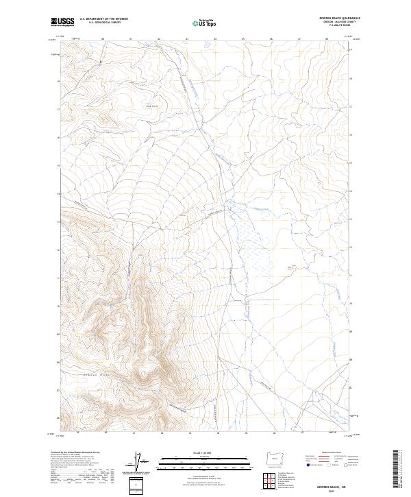
2023 Map of Bowden Ranch
USGS Topo · Published 2023About this map
Bowden Hills and the Red Hills define the high-desert topography of this Malheur County landscape. The area is characterized by a network of drainage systems including Rattlesnake Creek, Chimney Creek, and Battle Creek, which carve through the arid terrain. Remote access is provided by a few primitive routes such as Bowden Ranch Rd and Rattlesnake Creek Rd, tracing the paths between significant natural landmarks like Tudor Canyon and Wire Corral Canyon. The map reveals a land managed for ranching and resource use, where the naming of Beber Ranch Rd suggests the long-standing agricultural heritage of this high plateau region in eastern Oregon.
Find a feature on this map
15 named features on this map. Tap any name to fly to it.
Don’t see what you’re looking for? This feature index may not catch every label — zoom into the map to look around manually.
Map Details
Editions of this 2023 Bowden Ranch Map
This is the sole edition of this map. No revisions or reprints were ever made.
Other maps of this area

1955 · Jordan Valley
USGS Topo · 1:250,000

1957 · Jordan Valley
USGS Topo · 1:250,000

1958 · Jordan Valley
USGS Topo · 1:250,000

1979 · Rockhouse Reservoir
USGS Topo · 1:24,000

1979 · Bowden Ranch
USGS Topo · 1:24,000

1979 · Anderson Reservoir
USGS Topo · 1:24,000

1979 · Flat Top Mtn SE
USGS Topo · 1:24,000
1979 · The Basin
USGS Topo · 1:24,000
1980 · Jackies Butte
USGS Topo · 1:24,000

1982 · Rattlesnake Canyon
USGS Topo · 1:24,000