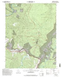
1995 Map of Bowden
USGS Topo · Published 1998About this map
Bowden and Evenwood anchor this study of the West Virginia highlands, where the Shavers Fork of the Cheat River carves a path through the Monongahela National Forest. The landscape reveals a complex history of resource extraction and preservation, with a strip mine and quarry mine operating near the protected reaches of the Otter Creek Wilderness. Notable industrial landmarks like a Tipple and Quarry stand alongside the local Fish Hatchery, indicating a diverse rural economy during the mid-1990s. Higher elevations such as Bickle Knob and McGowan Mountain overlook scattered settlements like Faulkner and Alpena. The map traces a network of remote drainages, including Pond Lick and Yellow Creek, while documenting specific landmarks like the Stuart Knob and Middle Point peaks. Family-named locations such as Weese and the high clearing of Baker Sods provide valuable touchpoints for those researching the genealogy and land use of Randolph County.
Find a feature on this map
70 named features on this map. Tap any name to fly to it.
Don’t see what you’re looking for? This feature index may not catch every label — zoom into the map to look around manually.
Map Details
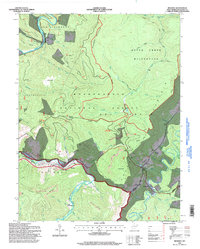
Editions of this 1995 Bowden Map
2 editions found
Other maps of this area

1886 · St. George
USGS Topo · 1:125,000

1889 · Beverly
USGS Topo · 1:125,000

1891 · St. George
USGS Topo · 1:125,000

1892 · Beverly
USGS Topo · 1:125,000

1907 · Belington
USGS Topo · 1:62,500

1908 · Parsons
USGS Topo · 1:62,500

1909 · Elkins
USGS Topo · 1:62,500

1922 · Horton
USGS Topo · 1:48,000

1924 · Horton
USGS Topo · 1:62,500

1926 · Parsons
USGS Topo · 1:62,500