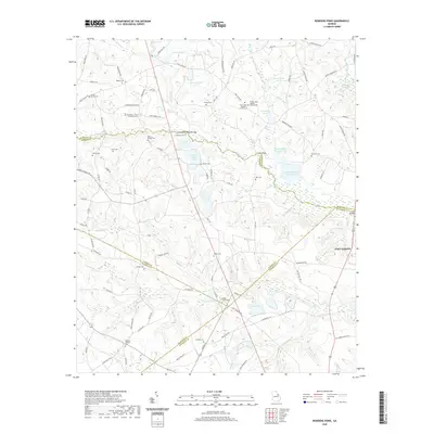
2020 Map of Bowdens Pond
USGS Topo · Published 2020About this map
The Poplar Head Baptist Church and its neighboring Fort Creek Church Cem anchor a landscape defined by its many rural burial grounds and water systems at the intersection of several Georgia counties. The terrain is marked by family-named landmarks like Mount Aldred Cem and the Barksdale - Story - Bradshaw Cem, which provide significant points of interest for genealogical research in this multi-county border region.
Find a feature on this map
111 named features on this map. Tap any name to fly to it.
Don’t see what you’re looking for? This feature index may not catch every label — zoom into the map to look around manually.
Map Details
Editions of this 2020 Bowdens Pond Map
This is the sole edition of this map. No revisions or reprints were ever made.
Other maps of this area

1920 · Stapleton
USGS Topo · 1:62,500

1922 · Harlem
USGS Topo · 1:62,500

1948 · Harlem
USGS Topo · 1:62,500

1948 · Stapleton
USGS Topo · 1:62,500

1948 · Harlem
USGS Topo · 1:24,000

1948 · Thomson East
USGS Topo · 1:24,000

1950 · Dearing
USGS Topo · 1:24,000

1950 · Wrens
USGS Topo · 1:24,000
1950 · Harlem
USGS Topo · 1:24,000

1950 · Matthews
USGS Topo · 1:24,000