
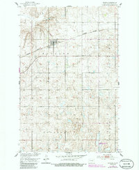
1951 Map of Bowdon
USGS Topo · Published 1952About this map
Bowdon serves as the central hub of this prairie landscape during the early 1950s, its street grid and grain elevators anchored by the Northern Pacific railroad line. The map reveals a highly organized rural structure, defined by the townships of Haaland, Progress, and Berlin within Wells County. This 1951 survey reflects a period when small country schools like Lincoln Sch and local burial grounds such as Wayside Cem and Mielke Cem were still essential landmarks for the surrounding farming community. The terrain is marked by numerous small depressions and several Gravel Pits, indicating the localized extraction industries that supported the development of the region's infrastructure and road network during the mid-century expansion of the Missouri River Basin project.
Find a feature on this map
10 named features on this map. Tap any name to fly to it.
Don’t see what you’re looking for? This feature index may not catch every label — zoom into the map to look around manually.
Map Details
Editions of this 1951 Bowdon Map
2 editions found
Other maps of this area

1945 · Manfred
USGS Topo · 1:62,500

1948 · Fessenden
USGS Topo · 1:62,500

1948 · Manfred
USGS Topo · 1:62,500

1949 · Fessenden SW
USGS Topo · 1:24,000

1949 · Emrick
USGS Topo · 1:24,000

1950 · Manfred SE
USGS Topo · 1:24,000

1951 · Heaton
USGS Topo · 1:24,000

1952 · New Rockford
USGS Topo · 1:250,000

1956 · New Rockford
USGS Topo · 1:250,000

1971 · New Rockford
USGS Topo · 1:250,000