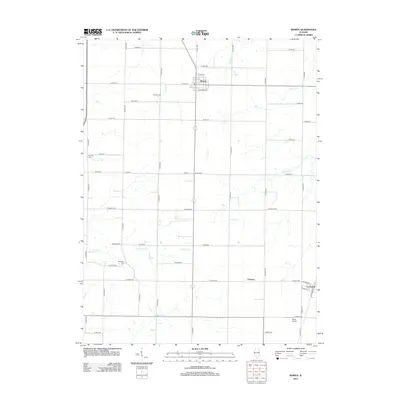
2012 Map of Bowen
USGS Topo · Published 2012About this map
Bowen serves as the primary hub of this rural landscape, situated at the intersection of several county routes and local streets such as E 1st St and E Church St. The surrounding terrain is defined by a dense network of waterways including Slater Cr, Flour Cr, and Thurman Cr that drain the agricultural fields of southeastern Hancock County. Further south, the map identifies the small community of Chatton and the village of La Prairie, reflecting a persistent pattern of small-town settlement in western Illinois.
Find a feature on this map
54 named features on this map. Tap any name to fly to it.
Don’t see what you’re looking for? This feature index may not catch every label — zoom into the map to look around manually.
Map Details
Editions of this 2012 Bowen Map
This is the sole edition of this map. No revisions or reprints were ever made.
Other maps of this area
1913 · Colchester
USGS Topo · 1:62,500
1933 · Carthage
USGS Topo · 1:62,500
1937 · Carthage
USGS Topo · 1:62,500
1946 · Augusta
USGS Topo · 1:62,500
1948 · Camp Point
USGS Topo · 1:62,500
1949 · Augusta
USGS Topo · 1:62,500
1958 · Burlington
USGS Topo · 1:250,000
1961 · Burlington
USGS Topo · 1:250,000
1963 · Burlington
USGS Topo · 1:250,000
1974 · Bentley
USGS Topo · 1:24,000