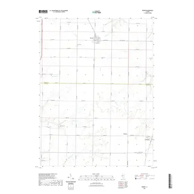
2021 Map of Bowen
USGS Topo · Published 2021About this map
Bowen serves as the primary hub in this western Illinois landscape, where a dense grid of county roads connects rural farmsteads and agricultural heritage sites. The village itself is intricately detailed with street names like N Morrell St and E Church St, while the surrounding terrain is defined by a network of drainage systems including Panther Creek and Flour Creek. These waterways dictate the subtle topography across the Hancock and Adams county line.
Find a feature on this map
64 named features on this map. Tap any name to fly to it.
Don’t see what you’re looking for? This feature index may not catch every label — zoom into the map to look around manually.
Map Details
Editions of this 2021 Bowen Map
This is the sole edition of this map. No revisions or reprints were ever made.
Other maps of this area

1913 · Colchester
USGS Topo · 1:62,500

1933 · Carthage
USGS Topo · 1:62,500

1937 · Carthage
USGS Topo · 1:62,500

1946 · Augusta
USGS Topo · 1:62,500

1948 · Camp Point
USGS Topo · 1:62,500

1949 · Augusta
USGS Topo · 1:62,500

1958 · Burlington
USGS Topo · 1:250,000

1961 · Burlington
USGS Topo · 1:250,000

1963 · Burlington
USGS Topo · 1:250,000
1974 · Bentley
USGS Topo · 1:24,000