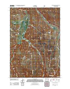
2011 Map of Bowen Valley
USGS Topo · Published 2011About this map
Powder River meanders through the heart of this landscape, defining the rural character of Bowen Valley in the early 21st century. The map illustrates a region managed by water and infrastructure, featuring several small impoundments such as Licklider Reservoir, S V Reservoir, and Vaughn Reservoir. These water sources are vital for the agricultural and ranching operations that utilize historical irrigation systems like the Shaw Stewart Ditch and Smith Ditch.
Find a feature on this map
42 named features on this map. Tap any name to fly to it.
Don’t see what you’re looking for? This feature index may not catch every label — zoom into the map to look around manually.
Map Details
Editions of this 2011 Bowen Valley Map
This is the sole edition of this map. No revisions or reprints were ever made.
Other maps of this area

1901 · Baker City
USGS Topo · 1:125,000

1955 · Baker
USGS Topo · 1:250,000

1959 · Baker
USGS Topo · 1:250,000

1967 · Virtue Flat
USGS Topo · 1:24,000

1967 · Encina
USGS Topo · 1:24,000

1967 · Baker
USGS Topo · 1:24,000

1967 · French Gulch
USGS Topo · 1:24,000

1967 · Dooley Mtn
USGS Topo · 1:24,000

1967 · Blue Canyon
USGS Topo · 1:24,000
1967 · Bowen Valley
USGS Topo · 1:24,000