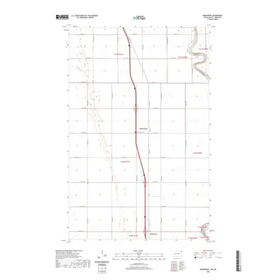
2020 Map of Bowesmont
USGS Topo · Published 2020About this map
Bowesmont and the small settlement of Pittsburgh occupy the fertile agricultural plains of the Red River Valley in this modern survey. The Red River of the N (Wakpa) serves as a meandering natural boundary along the eastern edge of the quadrangle, marking the divide between Pembina County, North Dakota, and Kittson County, Minnesota. The landscape is defined by a rigorous grid of section lines and rural roads, including Old Hwy 44 and numerous numbered streets and avenues. For those tracing local history, the Bowesmont Cem is a primary landmark situated near the town center. The map illustrates the contemporary transportation network and the enduring rural settlement pattern of the northeastern Red River Valley, where the topography remains relatively flat and dominated by agricultural development.
Find a feature on this map
31 named features on this map. Tap any name to fly to it.
Don’t see what you’re looking for? This feature index may not catch every label — zoom into the map to look around manually.
Map Details
Editions of this 2020 Bowesmont Map
This is the sole edition of this map. No revisions or reprints were ever made.
Other maps of this area

1939 · Drayton
USGS Topo · 1:62,500

1939 · Glasston
USGS Topo · 1:62,500

1939 · Pembina
USGS Topo · 1:62,500

1941 · Drayton
USGS Topo · 1:62,500

1941 · Glasston
USGS Topo · 1:62,500

1941 · Bathgate
USGS Topo · 1:62,500

1941 · Pembina
USGS Topo · 1:62,500

1952 · Thief River Falls
USGS Topo · 1:250,000

1956 · Thief River Falls
USGS Topo · 1:250,000

1957 · Thief River Falls
USGS Topo · 1:250,000