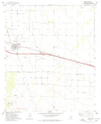
1974 Map of Bowie
USGS Topo · Published 1977About this map
Bowie serves as the central hub of this desert landscape in the mid-1970s, where the infrastructure of the Southern Pacific railroad and a nearby Landing Strip define the town's character as a transit point. The grid of the settlement includes a High Sch and a Substation, while the Desert Rest (Cem) lies just to the north. This survey captures a moment when the region relied heavily on subsurface resources, evidenced by the numerous instances of Well and Water Tank labels peppered across the arid terrain.
Find a feature on this map
19 named features on this map. Tap any name to fly to it.
Don’t see what you’re looking for? This feature index may not catch every label — zoom into the map to look around manually.
Map Details
Editions of this 1974 Bowie Map
This is the sole edition of this map. No revisions or reprints were ever made.
Other maps of this area

1917 · San Simon
USGS Topo · 1:125,000

1922 · Willcox
USGS Topo · 1:125,000

1926 · Cochise Head
USGS Topo · 1:62,500

1928 · Bowie
USGS Topo · 1:62,500

1943 · Dos Cabezas
USGS Topo · 1:62,500

1944 · Fisher Hills
USGS Topo · 1:62,500

1949 · Bowie
USGS Topo · 1:62,500

1950 · Bowie
USGS Topo · 1:62,500

1950 · Cochise Head
USGS Topo · 1:62,500

1954 · Silver City
USGS Topo · 1:250,000