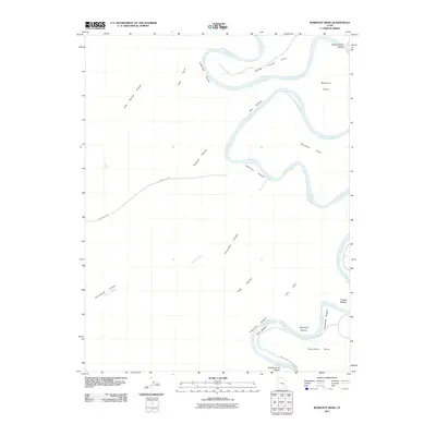
2011 Map of Bowknot Bend
USGS Topo · Published 2011About this map
The Green River carves a dramatic oxbow through the desert landscape, creating the eponymous Bowknot Bend in this section of the Utah wilderness. The waterway is flanked by numerous silt-rich flats including Spring Canyon Bottom, Oak Bottom, and Woodruff Bottom, which sit deep within the towering walls of Labyrinth Canyon. These alluvial bottoms historically provided rare accessible terrain along an otherwise vertical river corridor.
Find a feature on this map
23 named features on this map. Tap any name to fly to it.
Don’t see what you’re looking for? This feature index may not catch every label — zoom into the map to look around manually.
Map Details
Editions of this 2011 Bowknot Bend Map
This is the sole edition of this map. No revisions or reprints were ever made.
Other maps of this area

1885 · San Rafael
USGS Topo · 1:250,000

1885 · La Sal
USGS Topo · 1:250,000

1951 · The Knoll
USGS Topo · 1:62,500

1951 · Upheaval Dome
USGS Topo · 1:62,500

1952 · Tidwell 4 SE
USGS Topo · 1:24,000

1952 · Carlisle 2 NW
USGS Topo · 1:24,000

1952 · Tidwell 4 NE
USGS Topo · 1:24,000

1952 · Moab 3 SW
USGS Topo · 1:24,000

1952 · Moab 3 NW
USGS Topo · 1:24,000

1953 · Orange Cliffs 1 NE
USGS Topo · 1:24,000