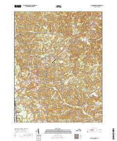
2019 Map of Bowling Green
USGS Topo · Published 2019About this map
Bowling Green serves as the seat of local government, centered on the Caroline County Courthouse where major thoroughfares like N Main St and S Main St converge. The landscape to the east is shaped by the sprawling footprint of the A P Hill Army Airfield (Fort A P Hill), a major military installation that influences the regional road network. The surrounding countryside is dotted with small settlements such as Wrightsville, Baylortown, and Antioch Fork, indicating a pattern of rural crossroads communities connected by winding routes like Shackleford Rd. Genealogists will find a wealth of burial sites across the terrain, including Anderson Family Cem and Beasley Cem, alongside older industrial landmarks such as Hicks Mill on Peumansend Cr. Multiple water bodies like Lonesome Gulch Pond and Beaverdam Pond define the drainage of the area toward Maracossic Creek.
Find a feature on this map
101 named features on this map. Tap any name to fly to it.
Don’t see what you’re looking for? This feature index may not catch every label — zoom into the map to look around manually.
Map Details
Editions of this 2019 Bowling Green Map
This is the sole edition of this map. No revisions or reprints were ever made.
Other maps of this area

1889 · Fredericksburg
USGS Topo · 1:125,000

1892 · Fredericksburg
USGS Topo · 1:125,000

1894 · Fredericksburg
USGS Topo · 1:125,000

1918 · Doswell
USGS Topo · 1:62,500

1918 · Aylett
USGS Topo · 1:62,500

1933 · Aylett
USGS Topo · 1:62,500

1942 · Bowling Green
USGS Topo · 1:31,680

1942 · Upper Zion
USGS Topo · 1:31,680

1942 · Woodford
USGS Topo · 1:31,680

1942 · Guinea
USGS Topo · 1:31,680