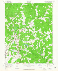
1949 Map of Bowling Green
USGS Topo · Published 1965About this map
The A P Hill Military Reservation dominates the northern landscape of this post-war survey, representing a significant federal footprint in Caroline County. The town of Bowling Green serves as the central hub, marked by its water tank, Lee Maury Sch, and the nearby Caroline High Sch. Outside the town center, the landscape is defined by the Richmond Fredericksburg and Potomac railroad passing through Milford, where a gasoline station and beacon are noted along the tracks.
Find a feature on this map
44 named features on this map. Tap any name to fly to it.
Don’t see what you’re looking for? This feature index may not catch every label — zoom into the map to look around manually.
Map Details
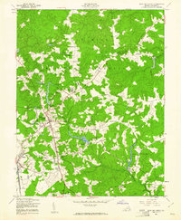
Editions of this 1949 Bowling Green Map
2 editions found
Other maps of this area

1889 · Fredericksburg
USGS Topo · 1:125,000

1892 · Fredericksburg
USGS Topo · 1:125,000

1894 · Fredericksburg
USGS Topo · 1:125,000

1918 · Doswell
USGS Topo · 1:62,500

1918 · Aylett
USGS Topo · 1:62,500

1933 · Aylett
USGS Topo · 1:62,500

1942 · Bowling Green
USGS Topo · 1:31,680

1942 · Upper Zion
USGS Topo · 1:31,680

1942 · Woodford
USGS Topo · 1:31,680

1942 · Guinea
USGS Topo · 1:31,680