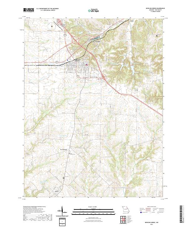
2021 Map of Bowling Green
USGS Topo · Published 2021About this map
Bowling Green serves as the focal point of this Pike County survey, centered around the Pike County Courthouse and a grid of residential and commercial streets. The surrounding landscape is defined by the headwaters of the Cuivre Creek and Sulphur Creek systems, which create a dendritic drainage pattern across the agricultural uplands. Notable smaller settlements such as St. Clement to the south and Ashley at the southern edge illustrate the rural community structure of the early 21st century. The map documents several legacy land markers, including family-named sites like Smith Cem and Ebers Brothers Lake, alongside modern infrastructure like the Bowling Green Municipal Airport. To the northeast, the small community of Tarrants sits near Bibb Lake, showing the persistent pattern of small-town centers and water resources that have shaped this region of Missouri.
Find a feature on this map
97 named features on this map. Tap any name to fly to it.
Don’t see what you’re looking for? This feature index may not catch every label — zoom into the map to look around manually.
Map Details
Editions of this 2021 Bowling Green Map
This is the sole edition of this map. No revisions or reprints were ever made.
Other maps of this area

1890 · Louisiana
USGS Topo · 1:125,000

1937 · Silex
USGS Topo · 1:62,500

1937 · Bowling Green
USGS Topo · 1:62,500

1939 · Silex
USGS Topo · 1:48,000

1940 · Bowling Green
USGS Topo · 1:62,500

1942 · Bellflower
USGS Topo · 1:62,500

1943 · Vandalia
USGS Topo · 1:62,500

1945 · Bellflower
USGS Topo · 1:62,500

1945 · Vandalia
USGS Topo · 1:62,500

1948 · Quincy
USGS Topo · 1:250,000