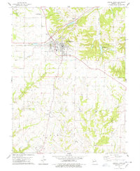
1978 Map of Bowling Green
USGS Topo · Published 1978About this map
Bowling Green serves as the regional hub in this late 1970s survey of Pike County, Missouri, characterized by the intersection of the Illinois Central Gulf railroad and several arterial roads. The landscape transition from the town’s grid into the surrounding rural townships of Cuivre and Ashley is marked by a network of drainage systems, including Irvine Branch and the various forks of Sulphur Creek.
Find a feature on this map
32 named features on this map. Tap any name to fly to it.
Don’t see what you’re looking for? This feature index may not catch every label — zoom into the map to look around manually.
Map Details
Editions of this 1978 Bowling Green Map
2 editions found
Other maps of this area

1890 · Louisiana
USGS Topo · 1:125,000

1937 · Silex
USGS Topo · 1:62,500

1937 · Bowling Green
USGS Topo · 1:62,500

1939 · Silex
USGS Topo · 1:48,000

1940 · Bowling Green
USGS Topo · 1:62,500

1942 · Bellflower
USGS Topo · 1:62,500

1943 · Vandalia
USGS Topo · 1:62,500

1945 · Bellflower
USGS Topo · 1:62,500

1945 · Vandalia
USGS Topo · 1:62,500

1948 · Quincy
USGS Topo · 1:250,000