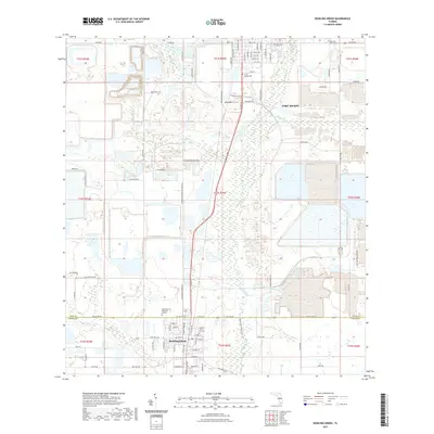
2021 Map of Bowling Green
USGS Topo · Published 2021About this map
The Peace River carves a central corridor through this Florida landscape, bridging the historical centers of Fort Meade to the north and Bowling Green to the south. This 2021 survey documents the established settlement patterns along the Polk and Hardee County line, where residential grids meet a patchwork of industrial and agricultural tracts. A notable concentration of genealogical sites is present, including the Bowling Green City Cemetery, Meade Cemetery, and New Hope Cemetery. Transport and recreation are defined by the CSX railroad corridor and the Peace River State Trail, which parallel the river's course. The terrain is marked by distinctive features such as Sand Mountain and the winding tributaries of Whidden Creek and Bowlegs Creek. Significant land use changes are visible in the large-scale excavations and water management areas that characterize the rural space between the two primary towns.
Find a feature on this map
80 named features on this map. Tap any name to fly to it.
Don’t see what you’re looking for? This feature index may not catch every label — zoom into the map to look around manually.
Map Details
Editions of this 2021 Bowling Green Map
This is the sole edition of this map. No revisions or reprints were ever made.
Other maps of this area

1949 · Bradley Junction
USGS Topo · 1:24,000

1950 · Bradley Junction
USGS Topo · 1:24,000

1952 · Homeland
USGS Topo · 1:24,000

1955 · Ft. Green
USGS Topo · 1:24,000

1955 · Bowling Green
USGS Topo · 1:24,000

1955 · Wauchula
USGS Topo · 1:24,000

1955 · Baird
USGS Topo · 1:24,000

1955 · Alturas
USGS Topo · 1:24,000

1956 · Bereah
USGS Topo · 1:24,000

1956 · Griffins Corner
USGS Topo · 1:24,000