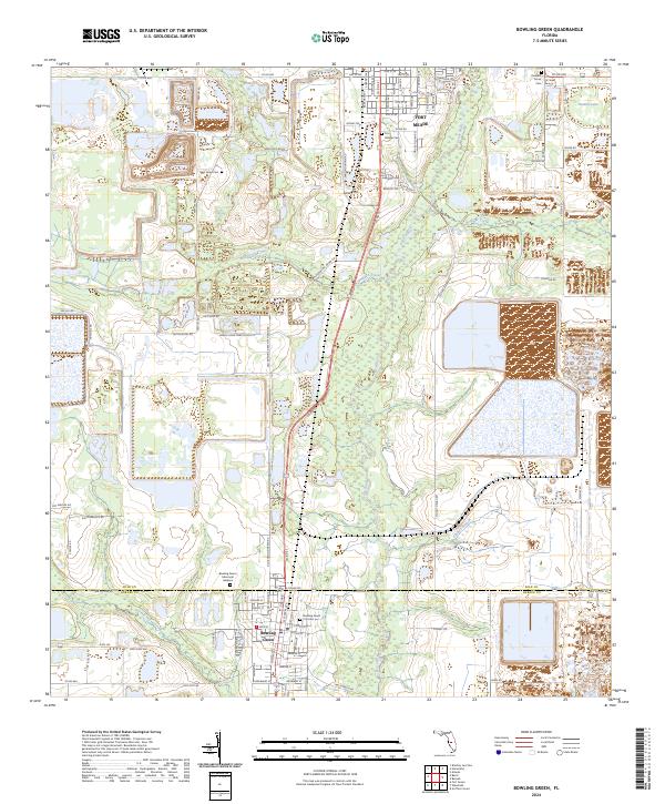
2024 Map of Bowling Green
USGS Topo · Published 2024About this map
Bowling Green sits at the intersection of industry and rural Florida, straddling the Polk and Hardee county line. This corridor is defined by the winding path of the Peace River and a landscape marked by significant terraforming and water management areas. To the north, the southern edge of Fort Meade appears, anchored by the Fort Meade Cem. The local economy and logistics are tied to the CSX Transportation railroad line, which runs parallel to the primary north-south highway. The area is dotted with several burial grounds including Pleasant Grove Cem and New Hope Cem, while Sand Mtn rises as a notable landform above the surrounding terrain. To the east, Twomile Lake and several unnamed water bodies highlight the region's complex hydrography, connected by drainage features like Whidden Creek and the Gilshey Branch.
Find a feature on this map
98 named features on this map. Tap any name to fly to it.
Don’t see what you’re looking for? This feature index may not catch every label — zoom into the map to look around manually.
Map Details
Editions of this 2024 Bowling Green Map
This is the sole edition of this map. No revisions or reprints were ever made.
Other maps of this area

1949 · Bradley Junction
USGS Topo · 1:24,000

1950 · Bradley Junction
USGS Topo · 1:24,000

1952 · Homeland
USGS Topo · 1:24,000

1955 · Ft. Green
USGS Topo · 1:24,000

1955 · Bowling Green
USGS Topo · 1:24,000

1955 · Wauchula
USGS Topo · 1:24,000

1955 · Baird
USGS Topo · 1:24,000

1955 · Alturas
USGS Topo · 1:24,000

1956 · Bereah
USGS Topo · 1:24,000

1956 · Griffins Corner
USGS Topo · 1:24,000